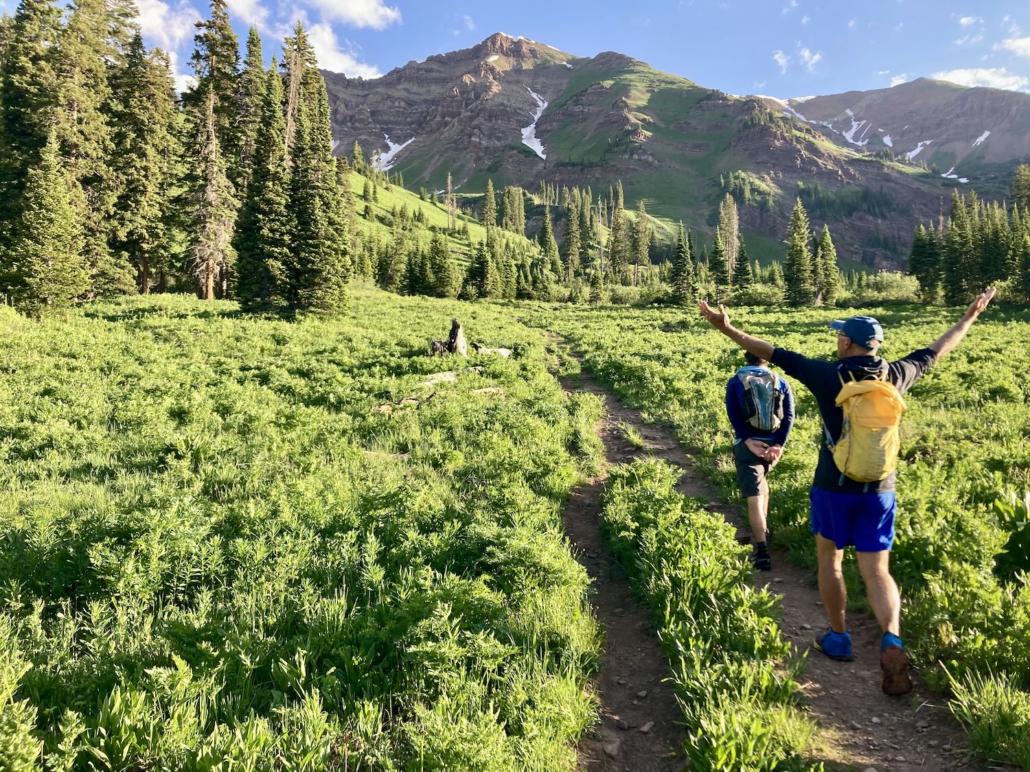
It’s Friday evening and we are starting into a busy weekend, but I wanted to get a quick conditions update posted for West Maroon Pass and Schofield Pass after finishing a hike through the area on July 7th.
My goal here is to try and not pass too much of my own judgment of conditions, as there is a huge spread in the skill sets of people we see on West Maroon Pass. Instead, I’ll try to just make a few points and mostly let a few pictures do the talking and the people make their own judgment of conditions.
Last winter produced an above-average snowpack for the area. Back in June, there was a lot of snow left in the high country. Now over the last couple of weeks, and into the start of July, the weather has been relatively hot with very low humidity. So the snow is melting and conditions are changing much quicker.
Summer Snow
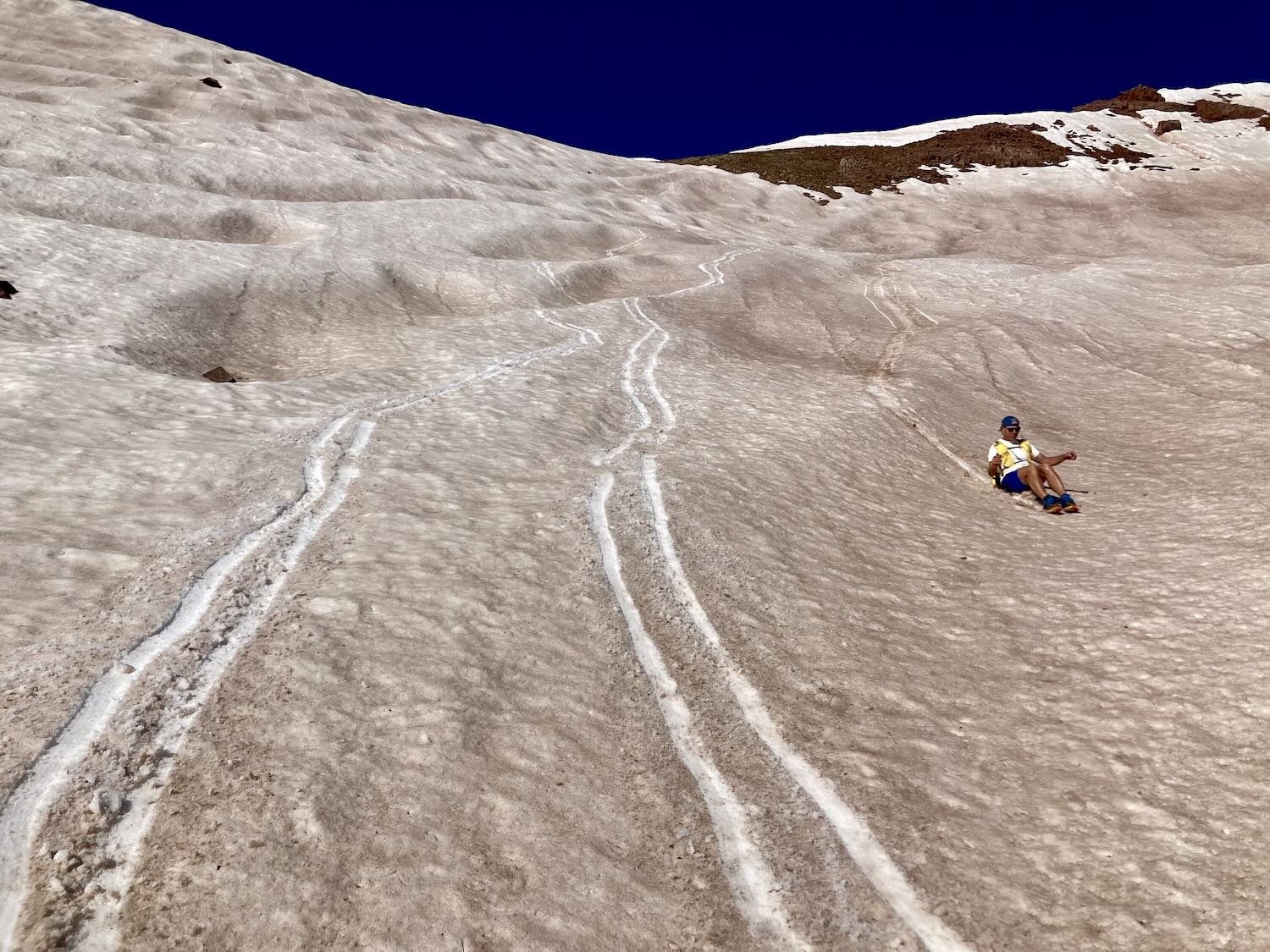
The remaining snow has transitioned. In this area, you can expect to walk on top of the snow and not posthole or sink to the ground unless the total snow depth is less than a foot deep.
Schofield Pass
Schofield Pass still has some snow on the road in the dark timber. It also isn’t possible to drive over due to a snow plug that will be there for some time. This is often the case. The West Maroon Pass hike starts or finishes near Emerald Lake on the pass and adds about 2 miles to the hike. Other than the extra distance it’s relatively easy enough to walk over the pass on the road.
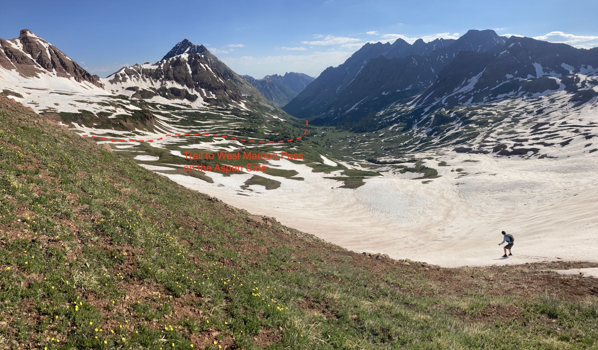
West Maroon Pass
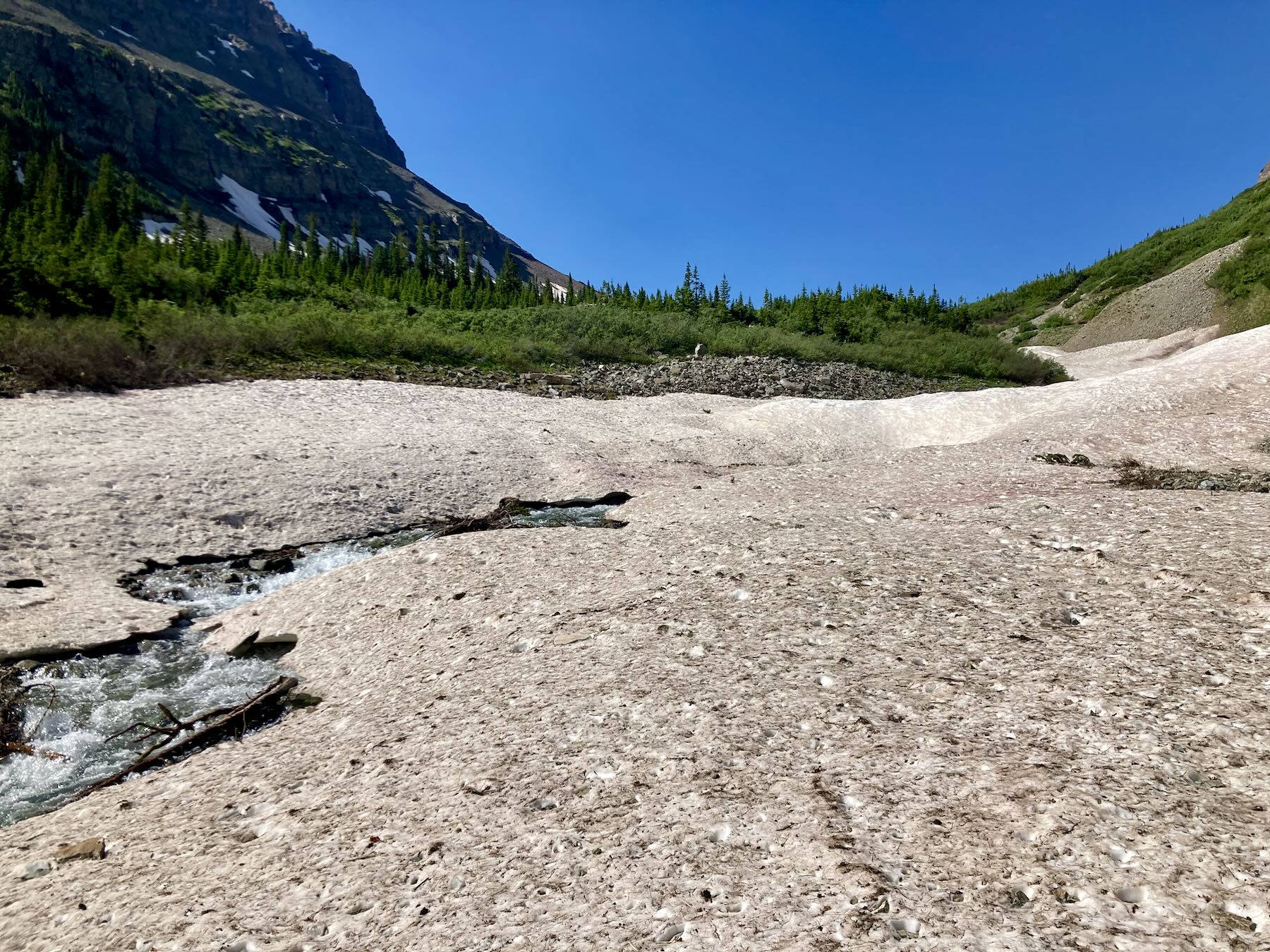
The steep slopes on the Crested Butte side of the pass are mostly melted out. There are snow fields on some of the lower-angled benches below the pass.
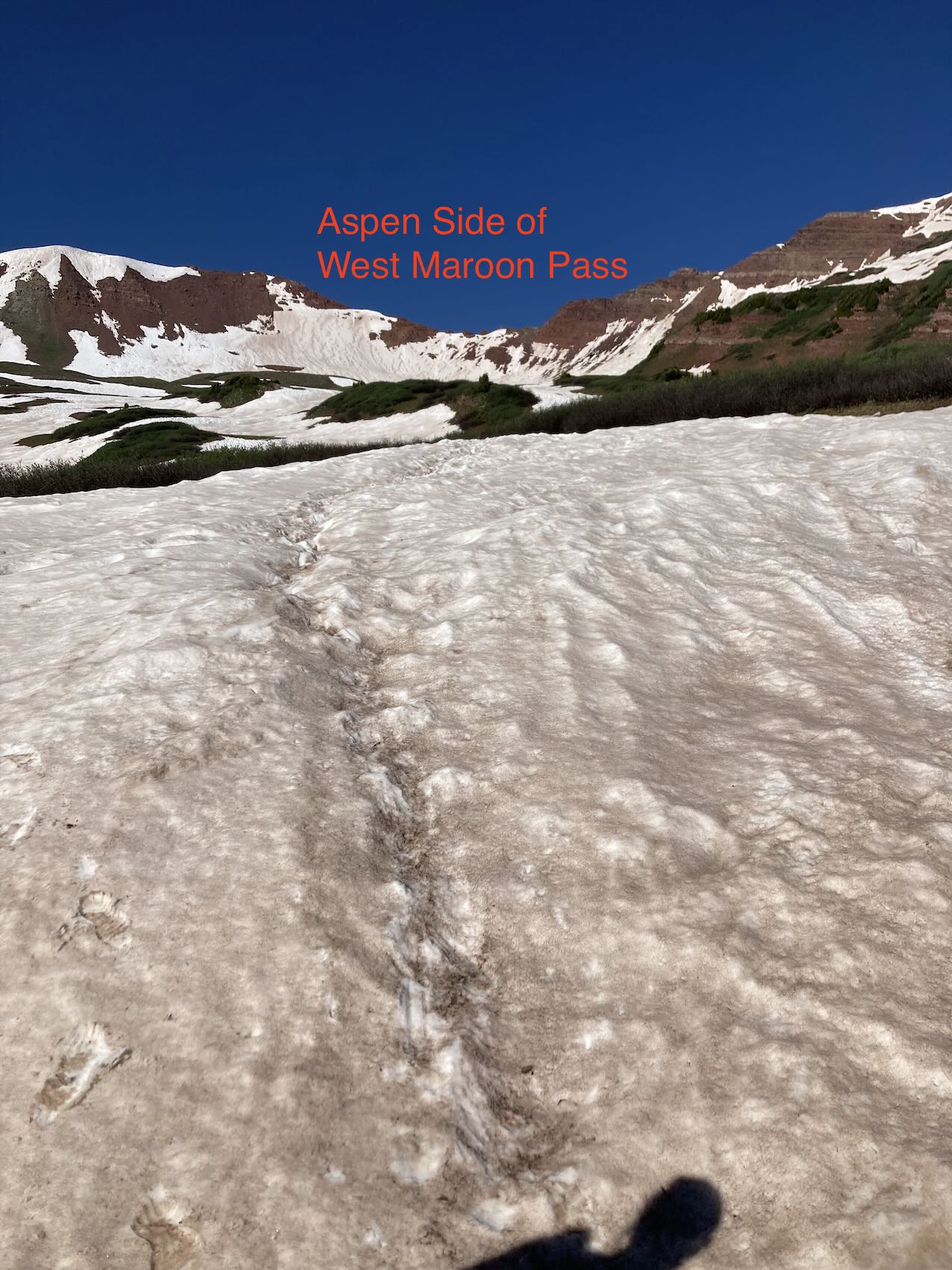
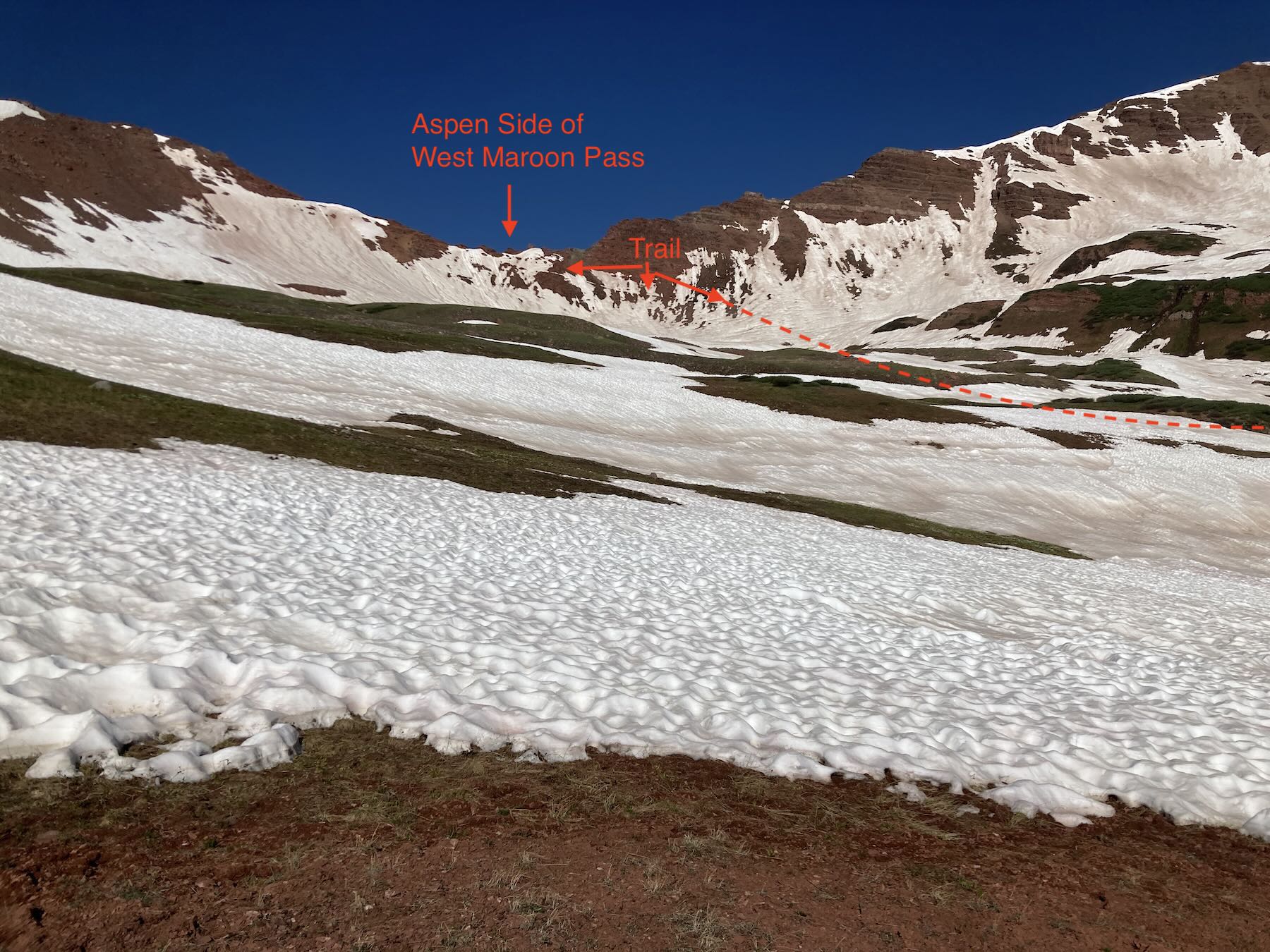
The steep slopes on the Aspen side of the pass are the most notable. Currently, there are still steep snow slopes right below the pass. If you were to fall you could certainly get hurt by sliding into exposed rocks. I bet there is a lot of change over the next week. You will need to be able to kick steps into the snow or find an area that has already melted out. Stiff-soled boots will help, and even micro-spikes or crampons. With that said, there were people making it through with running shoes. Again different people have different skill sets or comfort levels.
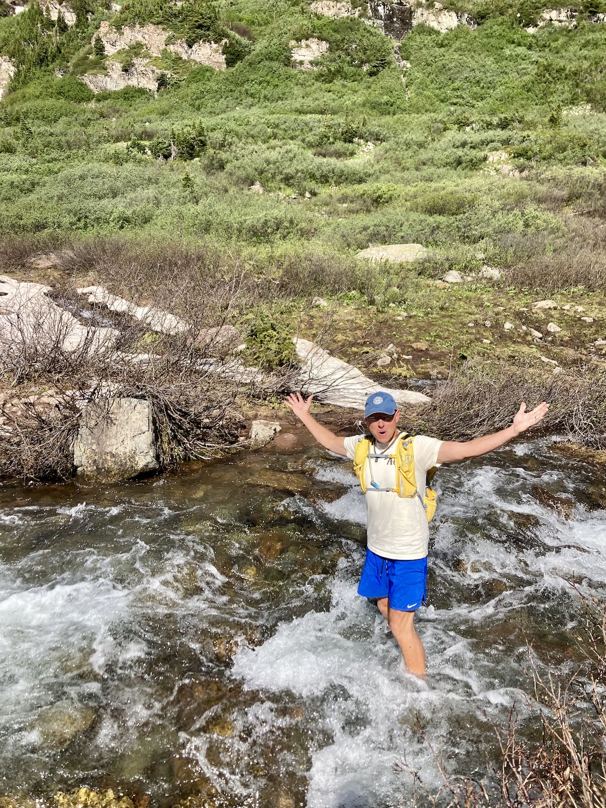
Below West Maroon Pass on the Aspen side, there isn’t too much that is notable. Of course, there are some snow fields left on the lower angled slopes in the upper basin. There are two main creek crossings on this side of the pass. The highest of the two was about knee-deep for us on Friday 7/7. The lower of the two looked like a similar depth but had a large and deep snow bridge that was easy to cross.
Where the trails disappear below some snow sections there is added route finding. Modern cell phone apps make this part much easier. All Trails and CoTrex are two free apps.
The photos of West Maroon Pass are from a distance. As we hiked over a slightly different portion of the ridge that connects to Rustlers Gulch.